2013年8月31日 星期六

Beirut貝魯特


Cultured Traveler
Call It Beyrouth: Beirut With a French Accent
By JAY CHESHES
Beirutis returning from France bring a craving for Parisian life, while the young embrace a Franco-flavored hybrid.
WORLD
Bombing in Beirut
Video shows the aftermath of a car bomb that tore through a southern suburb of Beirut on Thursday, killing at least 18 people and wounding nearly 300.


60 年代貝魯特素有小巴黎之稱.....


  1. Beirut
    Capital of Lebanon
  2. Beirut is the capital and largest city of Lebanon. As there has been no recent population census, the exact population is unknown; estimates in 2007 ranged from slightly more than 1 million to slightly less than 2 million. Wikipedia
    Area: 20 km²
    Weather: 26°C, Wind S at 11 km/h, 78% Humidity

Märchen 到格林兄弟博物館/紀念館


翻讀大美百科竟然有Märchen條目.
並用格林兄弟的著作 Kinder- und Hausmärchen (Children's and Household Tales)—seven editions, between 1812 and 1857當例子


我的問題是他 倆的紀念館我去過.現在想透過INTERNET找出
結果竟然找到柏林的新館 跟記憶中的相差10萬8千里  要請教偉強


Märchen 是德文 '童話',  Brüder Grimm Museum 位於 Kassel, http://www.grimms.de/
英文網址 http://www.grimms.de/index.php?id=105&site=Welcome%2FAbout+Us%2F

我們上次遊德國有到
Kassel, 我忘了有沒有到格林博物館, 你說的紀念館是不是這裡.

柏林的是 Humboldt University 圖書館的Grimm 研究中心非紀念館,

偉強

謝謝
我們上次有去. 我還在那兒看各國翻譯本.
這次還找到布來梅也有他們的網頁.
 或許是

Jacob and Wilhelm Grimm - The fairytale: the Bremen Town ...

www.bremen-tourism.de › ... › The fairytale: the Bremen Town Musicians
Jacob and Wilhelm Grimm were born in Hanau: ... ... and adaptations in more than 160 languages can be seen at the Brothers Grimm Museum in Kassel.


http://www.visitberlin.de/en/spot/jacob-und-wilhelm-grimm-zentrum-ub-der-hu-berlin

Jacob-und-Wilhelm-Grimm-Zentrum / UB der HU Berlin

Fairytale like new building

– © Milan Bilaty
“Jacob and Wilhelm Grimm Zentrum“ is paraded in large letters over the entrance of the monumental building in Berlin Mitte, near the Humboldt University. In the spring of 2009, the youngest new entrant of the Berliner libraries opened. With the imposing build, the university library receives its own building, which also harbours the library of the building’s founding name—the brothers Grimm.
The facility reminds one more of the ambience of a design-setter than the dignified venerable archive atmosphere of conventional libraries. The grate arranged skylights let lots of daylight in. In the largest of all the reading rooms, the architect allowed himself a cascade like arrangement of the levels. In total, there are 1,250 reading places and a main auditorium at one’s disposal. The readers can choose from a collection of 2.5 million books—the largest open access holdings in Germany.


The Brothers Grimm (German: Brüder Grimm or Die Gebrüder Grimm), Jacob (1785–1863) and Wilhelm Grimm (1786–1859), were German academics, linguists, cultural researchers, lexicographers and authors who together collected and published folklore.


Märchen das

(Märchens, Märchen)

fairy story; fairy tale; (ugs.) (Lüge) [tall] story (coll.)

2013年8月30日 星期五

中港路幾十年前貌與現今比較/台灣大道


M. Lin twitter
台灣大道的全名不是應該叫作台灣汪洋大道嘛??


........ 甚至中港路幾十年前貌與現今比較,都令我有種時空倒回的感受。.......

 ☆中港路的產業--服務組織「生產系統」及其「轉型」之例  297
 ---新書 轉型:統計品管可靠性與轉型的新經濟學The Trilogy of the New Economics of Dr. Deming

大連的薄熙來時代

薄熙來深知風險為何物。他曾位居中國政府高層,要是中國檢方所說屬實,他已無視法律多年,收賂、貪汙又濫權;他的審判於本周結束,應該很快就會被判有罪。
當薄熙來於1993年接任大連市長之時,他選擇了承擔風險。當時,大連並沒有太多優點可以幫助他的職涯,因此,他提出了具有高度政治風險的想法:大力吸引日本投資。
薄熙來為日本投資者推出特別優惠,並成立開發區和高科技園區。風險最大的或許就是,他讓自己成為吸引日本投資的代表人物,親自與任何造訪大連的日本一流企業總裁會面。這樣的策略奏效了,成千上萬日本企業在大連建立業務,其中還包括許多高科技和軟體公司。
薄熙來的早期盟友表示,他深知,如果想爬上高位,得靠大規模開發和優秀的經濟成長吸引目光才行。他相信,大連對日語和日本文化的了解,非常適合日本企業來此投資。
他並不擔心與過去的敵人作生意可能會引發政治問題。日本與大連之間的飛航時間不到兩小時,中國的勞動力低廉,新基礎建設和建築計劃可創造成本效益,而且大連還能讓日本人感到些許家的舒適感。
舒 適感不僅限於商業。就算到了今天,大連仍舊是日本商務人士周末休閒的好去處,他們可以在豪華渡假村打都有情人,這已是公開的秘密。在大連的華美達酒店吃早 餐,會讓一般旅客有種地理錯置之感。這裡不是日本,只是感覺起來很像日本;餐桌坐滿了日本商務人士,服務人員也全都會說日語。而在大連,還有許多地方都帶 有這樣濃厚的日本氣息。
日本佔領大連長達40年,以大連作為日本和中國之間的主要交易港。蘇聯掌管大連5年之後,才將大連交還中國,但大連 仍舊與日本保有深厚的關係。直到90年代初期薄熙來上任,大連才知道該如何利用這樣的關係。意外的是,中國近年諸多反日示威之中,大連並未成為目標;今 日,外國投資仍佔大連GDP相當一大部分,除了日本企業之外,英特爾等全球巨人也都有在大連設廠。
薄熙來卸下大連市長一職之後,仍舊與大連保有緊密的關係,日本企業的投資熱潮依舊持續。但大連有些人擔心,目前的市長李萬才選擇不與任何人會面、成本上升,對大連也沒有好處。這是否表示,如果薄熙來得以升至高位,他可能會是中國領導階層唯一的親日力量?曾與薄熙來合作過的日本商人表示,並不見得;他是個狡滑又精於政治算計的人,若他真正坐上高位,很有可能會對日本變得十分嚴厲。(黃維德譯)


The fallen leader's legacy in Dalian
Bo Xilai's Japanese history
Aug 29th 2013, 1:23 by K.M. | DALIAN
BO XILAI is no stranger to risk. He was once among China's highest ranking officials, and if Chinese prosecutors are to be believed, he played footloose with the law for years, engaging in bribery, corruption and abuse of power. His dramatic trial ended this week and he is likely soon to be found guilty. Prosecutors have calledfor "no leniency" to be shown in his sentencing.
When the ambitious Mr Bo took over as mayor of Dalian in 1993, he also took risks. Then a sleepy backwater, Dalian had few attributes he could use to boost his career. He seized on an idea that was potentially politically dangerous: heavily courting investment from the city's former occupier, Japan.
Mr Bo set up special incentives for Japanese investors and built a development zone and high-tech park. Perhaps riskiest of all, he made himself available and became the public face of the effort to woo Japanese investment.  If a president of a company from the top tier of Japan's stock market visited Dalian, Mr Bo would meet him personally. The strategy worked.Thousands of Japanese companieshave set up operations in Dalian, including many leading high-tech and software firms.
Confederates of Mr Bo from the early days say he knew that in order to move up the political ladder, he needed to get noticed with large-scale development and robust economic growth. Mr Bo believed Dalian's long-standing knowledge of Japanese language and culture made the city a natural fit for Japanese businesses, particularly those in the high-tech sector.
He was unconcerned about the possible political ramifications of doing business with a former enemy—one still unwelcome to many after the occupation 50 years earlier. Mr Bo was determined to persuade Japan that Dalian was open for business, while Korean investment flowed to Qingdao, further south. "There was a lot of empty land and he was ordered to fill the buildings," recalls a Japanese businessman who has worked in Dalian since Mr Bo's tenure. "He desperately wanted to return to Beijing one day, so he decided to fill the buildings one-by-one with foreign investment," he says.
Japan, less than two hours away by aeroplane, was a natural source of the investment Mr Bo wanted. Labour in China was cheaper and new infrastructure and construction projects promised cost-effective operations together with some of the comforts of home.
Those comforts went beyond business. Even today, Dalian is a weekend getaway for Japanese businessmen who want to play golf at one of the seaside city's luxury resorts and to while away the evenings with pretty local girls at the many Japanese-style karaoke parlours. It is an open secret that many Japanese businessmen have local long-term girlfriends in Dalian.
Breakfast at Dalian's Ramada Plaza Inn might leave a casual guest confused about geography. This is not Japan; it only feels that way. The tables are full of Japanese businessmen, quietly eating their morning noodles or chatting with colleagues about business deals. The service staff, all of whom speak Japanese, stand back from the tables, avoiding the ubiquitous hover of Chinese restaurants. But the Ramada Plaza Inn is not an isolated pocket in Dalian; many establishments cater to Japanese tastes and the entire city remains a major draw for Japanese businesses and pleasure-seekers.
Dalian's relationship with Japan began violently, as Japan forged its way toward creating a new nation with territory in China. For 40 years until 1945, Japan controlled the city, using it as the main trading port between China and Japan. The Soviet Union then took over for five years before turning it back over to China, but those long-standing links with Japan left a legacy in Dalian.
It was not until the early 1990s and the arrival of Mr Bo that the city figured out how to put those links to use. Intriguingly, Dalian's Japanese vibe has not made it a target during the many anti-Japan protestsin China in recent years. Today, foreign investment accounts for a large share of Dalian's GDP. In addition to Japanese firms such as Canon, Toshiba and Mitsubishi, global giants like Intel have also set up shop here.
Mr Bo left as Dalian's mayor in 2000, but kept close ties to the city as governor of Liaoning province (where Dalian is located), as commerce minister and even later, as party secretary in far-off Chongqing. In his trial, the charges against him dated back to his Dalian days, in particular the accusation that plastics mogul and billionaire developer Xu Mingbribed him. The two-storey headquarters of Mr Xu's Dalian Shide Group now sits vacant, his corner office empty of all but some scattered paperwork and a football jersey.
Mr Bo's legacy of bringing Japanese investors back to Japan does remain. But some here are wary of the city's new leadership, saying the current mayor, Li Wancai, "doesn't meet with anyone," and that rising costs do not help matters.
Does all this mean Mr Bo would have been a lone pro-Japan force in China's leadership had he escaped his purge and risen to higher power? Not likely, former associates of Mr Bo say. The man is cunning and politically calculating, not necessarily pro-Japan. Had he risen higher, "there is a strong chance he might have decided to become strict with Japan," says the Japanese businessman.
©The Economist Newspaper Limited 2013


2013年8月29日 星期四

Rhine Through the eyes of Willian Turner

Visit Germany

Through the eyes of a painter

William Turner's paintings are some of the most important among Rhine Romanticists. In 2014, a new route will link the places where the artist produced his famous works. DW's Anne Termeche learns more.
I have an appointment with Armin Thommes. He's a painter, Turner expert, and instigator of the new William Turner Route in the Middle Rhine Valley. From a small folder, he fishes out a copy of a watercolor painting that will be used to mark the route next year. The colors are delicate and fluid. Contours are barely perceptible, except for castle ruins set against a vivid orange and violet.
"Turner pioneered the Impressionist movement with his style," says Thommes, adding that the painter's landscapes helped spark the Middle Rhine tourism boom that began in the 19th century.
In 1817 the English painter made the first of many trips to the Rhine. Within two days he hiked from Koblenz to Bingen. I calculate the distance: That's about 60 kilometers (37 miles)! I'm happy that in this summer heat, Armin Thommes and I only have a short stretch to go. From St. Goar, we'll follow the banks of the Rhine to the southern end, where Turner painted a view of the Lorelei. St. Goar is located diagonally across from the famous cliff.
William Turner's painting, 'The Lorelei Rock' In August 1817 William Turner painted 'The Lorelei Rock'
Riddled with yearning
While hiking along the Rhine, the famous Brit sketched about 100 pages. Once he was home in England he then added color. About 50 large-format watercolors and oil paintings of the river were crafted in this way. Painters and poets from the Romantic period portray the Rhine landscape with a sense of longing.
William Turner's painting, 'The Lorelei Rock'
Provided by: Leeds Museums and Galleries (Leeds Art Gallery) U.K.; English, out of copyright In August 1817 William Turner painted 'The Lorelei Rock'
In some places I can imagine the towpath that Turner took. The Rhine Cycle Route now runs along the path where horses once pulled cargo ships upstream. Highway 9 parallels the Rhine. The traffic noise is a gentle hum compared to the hellish rumble of the trains that thunder through the narrow Rhine valley by the minute.
Turner experienced only silence here. For just one moment, I try to imagine it - to block out the noise, erase the campground and its trailers just across the riverbank, and ignore the cargo and cruise ships. I imagine a sailboat, drifting silently down the Rhine. Finally, listening to the steady murmur of the river, I begin to understand that you can be nostalgic for a place like this.
Since 2005 Armin Thommes has systematically scoured the shore landscape between Koblenz and Bingen. Thorny brambles reinforced by steep embankments didn't deter him.
"But something else makes orientation a bit difficult sometimes," says Thomas. "Turner wasn't really taken with reality. For him, the effect was the ultimate goal." Where nature lacked in drama, the painter gladly assisted. He combined visual axes and shifted a castle here or tower there.
"Good to see when looking at Oberwesel," promises Thommes.
Campers line the banks of the Rhine River
Campers instead of horse power
Oberwesel is a village just two river bends and seven kilometers further down the Rhine. Turner painted the town from an elevated vantage point, which Armin Thommes has perfectly identified.
No one knows how Turner got there, though. We take the high road, above the Rhine Valley, across from Lorelei. In blistering heat, the path winds through wheat fields, cool shady forests and vineyards. Now and then we catch a glimpse of the river below us. We reach our goal just as a herb of tour busses pulls up.
Armin Thommes leafs through his file: Turner's view of Oberwesel. "There was a second axis involved, take a look," he says.
In the photo a white tower is depicted. It's impossible that Turner could have seen that tower from this position. But it gives his landscapes a certain charm. By next year, all 26 positions that Armin Thommes has identified will be equipped with information boards. Then everyone will be able to see the landscape through the eyes of the artist and learn how Turner managed not only to paint the landscape, but to capture its essence.
Campers line the banks of the Rhine River
Photo: Anne Termeche / DW Campers instead of horse power
Birth of mass tourism
In Turner's day, traveling to the Rhine was trendy in intellectual circles. After the narrative was developed by painters, writers and thinkers, the landscape morphed into something extraordinary. "Their works are known today as 'Rhine Romantic,'" explains Thommes.
The Middle Rhine Valley was not prepared for what followed - one of the earliest examples of mass tourism in Europe. Today, hundreds of thousands of tourists visit the valley, which was listed as a UNESCO World Heritage site in 2002. Ideas like Armin Thommes' are welcome.
"The Turner Route speaks to visitors seeking culture, but also to those who have never heard of Turner," said Bertram Beck, chairman of the Middle Rhine Valley Association. The association is ensuring that the Turner Route becomes reality.
Man stands at edge of vineyard on path to Oberwesel Turner expert Armin Thommes enjoys the scenery en route to Oberwesel
We're back in St. Goar, where we started this morning. Turner enjoyed staying here during his travels on the Rhine. It's also Thommes' home. In St. Goar, as in many places along the Middle Rhine Valley, there is a dizzying collection of souvenir shops. For me, a real romance killer.
That evening I take refuge at the William Turner Plaza, one last tip from Arim Thommes. It's nothing more than a couple of wide, white stairs and simple stone benches on the riverbank. Behind me is Rheinfels Castle, to the left Maus Castle, across the way Katz Castle, and in front of me the Rhine in the evening sun.
Nearly 200 years ago, William Turner stood here. And he was perhaps just as enchanted as I am now.

The mystical pull of the Rhine

2011/4/3

一周点评:欧洲重新展开对核能的讨论

The Rhine is one of the most important rivers in Europe.
Wikimedia Commons: Rhine

能源、核電、電力、熱能, 這是上週歐洲關注的焦點。由於日本福島核電站發生的災難,一些歐洲國家對核能的替代方案展開激烈的爭論。還有一些國家根本就沒有討論。雙方之間是多麼的不同,看一看歐洲最長的河流萊茵河就一目了然。這條河流構成了德國和法國之間一段很長的邊界。法國是對核電依賴程度最高的國家。該國大約80%的電能來自核電站,其核電比例之高居世界首位。而在德國,其公民歷來反對核能。德國的核能只佔全部電力供應的25%。
上週末,德國總理默克爾的保守黨在一次重要​​的地區選舉中遭受失敗,原因就是因為公民反對核能。他們不想讓保守黨重新恢復核電站的運營或者延長老核電站的使用期。德國綠黨在地區選舉中因此勝出。大約30年前綠黨成立的初衷就是抵制核電站。在德國,反核能運動全面發展。
與此同時,萊茵河彼岸的法國則認為核電站絕對安全。在法國的費森海姆,那裡有歐洲最古老的核電站,但是當地沒有人對核電站提出抗議和批評。


****

2010/12/29 收到Justing 寄來的 萊茵河

出自維基百科,自由嘅百科全書

萊茵河(德文:Rhein,瑞士德文:Rhy,法文:Rhin,荷蘭文:Rijn,羅曼什文:Rein)係歐洲第四長嘅,有1230公里,短過伏加河多瑙河聶伯河。萊茵河由瑞士阿爾卑斯山區開始流,經列支敦士登奧地利德國法國,最後去到荷蘭流入北海
English

《莱茵河——历史、神话和现实》

[法]吕西安·费弗尔著

许明龙编译

辽宁教育出版社2003年1月出版,185千字。
目 录

译序 超时代的真知灼见
——吕西安·费弗尔的《莱茵河》一书的价值…………………………郭华榕 1
告读者……………………………………………………………………………… 15
1935年版序言……………………………………………………………………… 17
第一章 莱茵河的三个题目……………………………………………………… 1
Ⅰ.“通道”一条大河的形成……………………………………………………… 2
Ⅱ.天然边界……………………………………………………………………… 12
Ⅲ.两个种族之间的莱茵河……………………………………………………… 20
第二章 三个形象,三种酵母…………………………………………………… 34
Ⅰ.罗马化地区…………………………………………………………………… 34
Ⅱ.蛮族…………………………………………………………………………… 52
Ⅲ.教会…………………………………………………………………………… 79
第三章 从城邦到国家…………………………………………………………… 98
Ⅰ.莱茵河城市…………………………………………………………………… 98
Ⅱ.从城市到君主…………………………………………………………………136
Ⅲ.走向两个民族间的莱茵河……………………………………………………156
第四章 一条边界是如何形成和消失的…………………………………………177
Ⅰ.莱茵河:从法国的界河到法兰西帝国的流域………………………………177
Ⅱ.莱茵河:从德意志的界河到德国的河流……………………………………189
结束语:回眸往昔………………………………………………………………204
附录………………………………………………………………………………208
Ⅰ.第一版(1931年)结束语………………………………………………………208
Ⅱ.关于莱茵河经济史的若干思考(1953年)……………………………………212
Ⅲ.皮特·舍特勒拟定的补充书目…………………………………………………222
参考书目……………………………………………………………………………239


Visit Germany

The mystical pull of the Rhine

In 2002 the Upper Middle Rhine Valley was named a World Heritage site. The Rhine's real heydey, however, was 200 years ago when the Romanticists first discovered the river and made it their muse.
English poet Lord Byron was so enraptured by the ruins on the Drachenfels mountain in 1816 that he immediately reached for his pen and wrote the famous lines of "The Castled Crag of Drachenfels."
Byron wrote with fervor that he would like to spend the rest of his life at the foot of the tower-crowned mountain. His verses sparked an avalanche of nature-inspired poetry and also kicked the Rhine tourism industry into gear.
The region is known as Siebengebirge or Seven Mountains. Today, the Siebengebirgsmuseum in the sleepy town of Königswinter near Bonn illuminates the Romanticists' fascination with Germany's most famous river. The exhibition hall is in just the right place: When visitors exit the train, they see the Drachenfels mountain and the Drachenburg castle looming majestically in the sky.
Georg Schneider's 'Ruins of Ehrenfels by Moonlight,' 1790 Georg Schneider's 'Ruins of Ehrenfels by Moonlight,' 1790

Painters' muse
The area on the Rhine is a popular tourist destination that is mentioned in every guidebook. Not only poets like Heinrich Heine, Clemens Brentano or Joseph von Eichendorf visited the region, but numerous painters also ventured here to interpret the landscape with their brushes.
"The mix of this region fascinated artists," said the museum's director, Elmar Schueren, "On the one hand, it was the scenery that lends itself beautifully to being painted, and on the other hand, it was the activity of the people."
Castles on the left and the right of the Rhine were witness to this activity. During the Middle Ages they were built as obsolete. New weapons techniques made them superfluous and, built for battle, they didn't make suitable residences.
It's amazing that any are left standing at all, said Scheuren, because some were used as stone quarries for the construction of churches. Even the stones of the Cologne Cathedral stem from the Rhine. Up until the 19th century, the gray stone of Drachenfels was dismantled and shipped to Cologne.
Rhine scene painting, unknown artist, 'View of Rüdesheim and of the Rhein' Unknown artist, 'View of Rüdesheim and of the Rhein,' ca. 1820/25
The other landscape
For the Romanticists the ruins along the Rhine provided just the right amount of eerie inspiration they needed for their art. Their works also became political symbols of a growing national sentiment in the 19th century.
While the wild and untouched nature inspired the artists, signs of civilization and progress also surfaced in their art. Johannes Jakob Diezler crafted the painting "Niederlahnstein and Kappellen-Stozenfels" in 1830, portraying a perfect idyll - but only at first glance.
Upon closer examination, you'll see that the artist wasn't only interested in beautiful scenery, but that the painting also depicts modern infrastructure. A steamboat glides through the Rhine; a vineyard dots the riverbanks; a carriage brings travelers to the river.
"The cultural landscape was, for them, the landscape," explained Scheuren.
Birth of the Lorelei
The Romanticists had plenty of imagination; they exaggerated the landscapes they saw and projected their own fantasies into them. One result was the legend of the Lorelei.
Prior to the 19th century, the Lorelei was nothing more than a slate rock at St. Goarshausen near Koblenz. Due to shallow spots in the channel, the passage was dangerous, and a number of shipwrecks occurred.
The legend of a mystical mermaid, who sat on the rock, combing her golden hair and casting sailors under her spell of song, can be traced back to the year 1801.
In his ballad, "In Bacharach on the Rhine," Clemens Bentano described an enchantress in the village. At this time, the rock played no role. It wasn't until the 1820s that Heinrich Heine revisited the story and placed the hair-combing enchantress from Bacharach on the stone.
"As such, the legend was perfect," said Scheuren, adding that the story of Siegfried the dragon slayer came about in a similar manner.
"The dragon fight was pure fiction," he said. "The story first appeared in the 18th century. The debate ran for a few years; then it became a legend that continues today."
Johannes Jakob Diezler's 'Niederlahnstein und Kapellen-Stolzenfels,' 1830 Johannes Jakob Diezler's 'Niederlahnstein und Kapellen-Stolzenfels,' 1830
Landscape of memories
What didn't exist was quickly invented. The Rhine depictions by Swiss painter Ludwig Bleueler demonstrate a contradiction between dream and reality. One of his pictures of Mainz shows a park with people milling about and a locomotive passing through.
"At that point the railway on the left side of the Rhine was only in the planning stages," said Scheuren. "When it was opened, Bleueler had been dead for three years."
The ongoing spread of technology didn't just change the portraits of the Rhine. At the end of the 1820s, thousands of tourists flocked to the region. The exclusive production of photos gave way to mass consumption.
Steamboats began offering affordable travel, and even members of the British royal family - attracted perhaps by the verses of their national poet Lord Byron - visited the acclaimed river.
The popularity of Rhine artwork peaked at the end of the 19th century. In the 20th century, long-distance travel replaced vacationing on the Rhine. Nevertheless, the beloved river has not been forgotten. At 350 meters, Drachenfels is allegedly the most-climbed mountain in Europe.


Under the spell of the Lorelei

Visit Germany

Under the spell of the Lorelei

Men are said to succumb to her spell, just by casting a glance her way. But Lorelei is more than an enchanted mermaid: she's a legendary beauty, tourist magnet and employer.
The quiet Rhine village of Assmannshausen is home to about 1,000 residents. Here, the boardwalk is mostly comprised of jetties reaching out into the river. A woman with sunglasses and a loud voice is perched on one of the piers, pitching boat rides to passersby.
"A trip to Lorelei for you?" she calls to strolling tourists. Across from her, a handful of people have gathered. They sit on benches and watch as a ship approaches the landing.
The tourist ship travels down the Rhine to Lorelei - or more accurately the rock named after her. Armed with cool drinks and ice cream, the visitors settle into their seats on the sunny top deck of the boat. They hail from around the globe: the Netherlands, the US, Germany, Israel and Brazil. Most have heard the legend of Lorelei, but few volunteer to retell the story.
Lorelei on the Rhine River What a bit of imagination can do ...
Bustling with boats and tourists
Each year about 20 million visitors venture to the Middle Rhine Valley for a day trip. In 2002 the Upper Middle Rhine Valley - between Koblenz and Rudesheim - was named a UNESCO World Heritage Site, which includes the 132-meter (433-foot) slate rock of Lorelei. Fleets of tourist boats float to the site each day.
On deck the wind ruffles hair. Passengers laugh and photograph old castles, half-timbered houses and lush vineyards that pass by slowly. After about 90 minutes, the Rhine makes a final turn to reveal Lorelei - rugged, high and unimpressive were it not for the legends, myths and verses winding around it, just like the Rhine. But - unlike the river - Lorelei stories made it across the Atlantic.
From enchantress to singing mermaid
Lorelei tour guides have Clemens Bentano to thank their profession. As a Romantic poet, Bentano invented Lorelei's tragic story around 1801. He crafted her as an "enchantress" from the small village of Bacharach, near the rocks. Her magic powers? She charmed all men with her beauty. As a result, a bishop ordered that she be brought into a monastery. On the way there, thinking she could get one last glimpse of her beloved, Lorelei slipped from atop the cliff and fell below into the Rhine.
Not many know the original version of the story. What truly catapulted Lorelei to literary fame was a poem by Heinrich Heine, which he wrote about 20 years later. It has been set to music about 300 times; the best-known version was done by Friedrich Silcher. In Heine's adaptation of the story, Lorelei is no longer an enchantress, but a mermaid who parallels the sirens in Greek mythology, serenading defenseless sailors until they capsize.
Nico Gradowitsch has never heard Lorelei sing, though he's been operating boats over the rocks nearby for about five years. He is 31 years old, and it's clear that the Rhine water flows through his veins. His family has owned a ferry service here since the beginning of the 20th century.

American tourist shares his take on the Lorelei

Proceeding with caution
Technically speaking, the Middle Rhine Valley is a challenge to navigate. In the river's narrow channels, Gradowitsch must pay close attention to oncoming traffic. At Lorelei, the Rhine allegedly reaches its deepest point at 25 meters.
"From of the bonds of love, there was no more rescue," laments Brentano at the beginning of his Lorelei poem. The jinxed enchantress is nevertheless a blessing for Nico Gradowitsch and his family. The hype around her guarantees full boats. Gradowitsch can risk a glance now and then to Lorelei's rock, from the cab of his boat. Blonde beauties come only as tourists to the Middle Rhine Valley.

墨西哥 墨西哥

 近日有一篇墨西哥市數十年與空氣污染奮戰有成的報導.......

書面知識散放在各處.  昨天是我的墨西哥日. 還買本其藝術指引的書(A Guide to Mexican Art : From Its Beginnings to th...芝加哥大學出版社). 今天午後想再續昨天之緣份. 先拿取Oxford Companion to Art 墨西哥藝術只記Modern部份. 而且此條跟Oxford Companion to Twentieth Century Art 的類似  ---因為編者同一人  此文一稿兩用......

反倒是我平常不怎麼參考的 大美百科  它有近40頁總體的墨西哥相關資訊的介紹  還有樓下的那座公共圖書館.......

2013年8月27日 星期二

The 25 Most Beautiful Public Libraries in the World

The 25 Most Beautiful Public Libraries in the World

臺北市立圖書館北投分館,一座山清水秀蓮花美的綠建築,緊鄰著綠意盎然的北投公園,與北投溫泉博物館晨昏相視,它不僅是台灣第一座綠建築的圖書館,也在去年被美國網站 Flavorwire.com評選為「全球最美25座公立圖書館」之一。此館擁有地下一層、地上二層,樓地版總面積650坪,屋頂為輕質生態屋頂,設有太陽能光電板發電,可發電16千瓦。
資訊來源:http://www.flavorwire.com/280318/the-25-most-beautiful-public-libraries-in-the-world

Gorky Park,Moscow

Gorky Park has changed since it was the grim setting of a 1981 murder novel.

Moscow Journal

Gorky Park, Once Drab, Now Glows

By DAVID M. HERSZENHORN

The park has transformed over the past two years into an extravagant urban recreational space that offers Muscovites a respite from the intense political pressures of Russia. 


Moscow: 10 Things to Do

7. Gorky Park

Visitors roller skate at Moscow Sergei Vasilyev / ITAR-TASS / Landov

It's not just where Martin Cruz Smith set his novel — which everyone around here knows and finds very funny. It's also a great spot to get an ice cream cone, take a walk along the Moscow River, and watch the locals at play — having a picnic, drinking, drinking some more, singing and cavorting. Make a point of entering the park at the Park Kultury metro station. You can't miss it: There's a huge, Brandenburg Gate–style structure that sits outside the entrance. Proceed toward the river, skip the Ferris Wheel, continue parallel to the river all the way to the Uzbek restaurant Chihana, where it would be very wise to get one of their specially prepared lamb dishes, a glass or two of red wine and green tea. Outside seating is available, or patrons can stretch out with a large pipe, or houka, in a darkened indoor lounge that feels more Central Asian than European. (It's a five-minute walk to Chihana from the Park Kultury metro; ask someone for directions toward the Neskuchny Sad bridge. The restaurant is near the rear entrance of Gorky Park and the lovely Neskuchny Sad garden.) After your meal, follow the path out of the park to the yellow and blue pedestrian bridge that spans the river; some of the best views of the city can be found here.
Jump to: navigation, search
Gorky Park
RIAN archive 510373 Pond in Gorky Park.jpg
Pond in Gorky Central Park of Culture and Leisure, 1982
Location Moscow, Russia
Coordinates 55°43′53″N 37°36′14″ECoordinates: 55°43′53″N 37°36′14″E
Opened 1928
Area 300 acres (120 ha)
Website Gorky Park
Gorky Central Park of Culture and Leisure (Russian: "Центральный парк культуры и отдыха (ЦПКиО) имени Горького") is an amusement park in Moscow, named after Maxim Gorky.

2013年8月26日 星期一

東京湾の海水浴場、半世紀ぶり復活 限定「及膝」戲水


東京湾の海水浴場、半世紀ぶり復活 「ひざまで」限定

写真:東京都心で51年ぶりに海水浴場が開かれた葛西海浜公園西なぎさでは、親子連れらが水遊びを楽しんでいた=10日、東京都江戸川区、小川智撮影拡大東京都心で51年ぶりに海水浴場が開かれた葛西海浜公園西なぎさでは、親子連れらが水遊びを楽しんでいた=10日、東京都江戸川区、小川智撮影
図:葛西海浜公演拡大葛西海浜公演
 【別宮潤一】東京湾の水質悪化で消えた東京都心の海水浴場が今夏、51年ぶりに復活した。汚れた海を都や民間団体がきれいにしてきた結果だが、それでも海に入れるのは「ひざまで」。2020年五輪が東京に来ればトライアスロン選手が泳ぐ海だけに、都も浄化に必死だ。
 「カニに挟まれた!」。今月中旬、東京都江戸川区の葛西海浜公園の波打ち際に、100人超の水着姿の子どもたちの歓声が響いた。「20年前より随分透明になった。海開きしたと聞き、孫を連れてきたんだ」。近くの自営業、藤村生男さん(73)は、海からなかなか戻らない孫の平沢幸太君(10)に目を細めた。
 同区のNPO法人「ふるさと東京を考える実行委員会」によると、戦後複数あった東京湾内の都内海水浴場は人口増による生活排水で汚れ、最後に残った葛西地区も1962年に閉鎖された。2006年、泳げた当時を知る地元住民らが「泳げる東京湾を取り戻そう」と実行委を設立した。

2013年8月23日 星期五

Evora / 聖雅各之路朝聖(吳家恆)


游常山

轉貼自吳家恆

幾個禮拜前的某個晚上,我和一個翻譯過幾本義大利文小說的朋友,在板橋的一處公車站等車。那是乍寒乍暖的三月,下著雨,又濕又冷,公車遲遲不來,我們聊到她和先生去葡萄牙的旅行,租了車在幾個有著建築趣味的城鎮遊歷,聽起來就是很過癮的旅行。
我說我也去過葡萄牙,但只到了東部靠西班牙邊境的艾佛拉(Evora)。她微露驚訝之色,他們那趟旅行也去了這個地方。自然是如此,提到葡萄牙,一般人最可能去的是里斯本。艾佛拉不要說去,恐怕連聽都沒聽過。這座自羅馬時代就已經建立的古城,保存了葡萄牙黃金時期的風貌──要不是一七五五年的大地震,這份榮耀本應該屬於里斯本的。在城鎮的高處,還有一座羅馬神殿的遺跡,經歷了蠻族入侵和伊斯蘭的統治,還有很長一段時間被基督徒當成屠宰場,完全不顧這裡本來祭獻的是戴安娜女神。
我凝視著馬路上一塊一塊的水跡,雨絲不斷飄落,開啟了我的回憶。我想到在艾佛拉的那個晚上,我們一群人走在狹窄的古老巷道裡,彎進一個小酒館。一位年輕女歌者得中年男子的伴奏,在幽暗飄搖的燭光中忘情地唱著時而悲傷、時而激昂的旋律,盪人心懷,這正是葡萄牙民謠fado的特色。坐在身旁的女士沒帶錢出來,我請她喝了一杯酒。她是紐約華爾道夫飯店有史以來第一位女主廚,這樣的請客機會不是天天都有,我主動提議,欣然會帳。去年,我接到她癌症過世的消息,心中頗為悵然。
人過三十近四十,一個明顯的改變就是開始接到朋友的死訊。親戚是天生來的,沒得選,大有緣淺情淡者,而朋友則是因緣巧合來的。正因為如此,朋友的死訊有時比親戚的去世還要讓人錯愕。而這錯愕,卻是三十之人要學著接受的。
那趟旅行回到馬德里之後,我單獨北行,走在「聖雅各之路」(carmino de Santiago)上。那已經是五年前的事,一次沒由來的旅行,突然出現實現的機會,以未竟告終。但這五年來,它始終都以某種形式存在於我的生活,不時冒出頭來,在朋友的閒談中、在雜誌的邀稿中、在深夜告知死訊的電話中、在三月的雨夜中。

HC: 20年幾前或許從NHK等知道此朝聖之路. 有專書. 可惜搬家不知藏於何處. 今日略讀此遊記很感謝. 應該去Wikipedia找相關項目 幫助讀者有些文化地理上的知識


轉貼自遠流出版社副總編輯吳家恆的西班牙遊記
聖雅各之路朝聖

我最早是在旅遊探險頻道的「勇闖天涯」知道有這麼一條聖雅各之路,橫亙於西班牙的北部,結束於伊比利半島西北端的聖地牙哥(Santiago de Compostela),這個地名的意思是「星光之地聖雅各」,自始就和這條朝聖路分不開。西元四十三年(這個時間各家說法略有出入),耶穌門徒大雅各被 希律王斬首殉教,屍身被人載於小船,橫越了地中海,出直布羅陀海峽,北行,最後埋骨於伊比利半島的西北端。這海濱之地有個令人絕望的名字──地之角 (Finisterre)。義大利南部也有個地方是這個名字,但此處才是歐陸的最西端,陸地在此沒入海洋,古人以為自此而西,是無垠汪洋,邊緣有深淵,還 有怪物出沒。我想那埋雅各的人是一心遠離羅馬帝國,才會選在這地極之處埋骨。
既然如此,為何不南行到非洲,可以離得更遠些?更可疑的是,雅各埋骨的消息,是過了八百年之後,一位法國的主教說是在星光的指引下,來到伊比利半島的西北 角,發現了墳塚。那段期間陸續發現了不少聖徒的埋骨處,讓人懷疑這到底是「發現」,還是「發明」。那是歐洲即將走向中古高峰期,宗教熱潮方興未艾的年代。 而西班牙在所謂「收復」(Reconquista)運動中,把那從來都不屬於西班牙人的土地,從伊斯蘭教徒的手中奪回。發現聖徒埋骨處的消息,鼓舞著基督 徒的士氣,掀起朝聖的熱潮,其中又以羅馬、耶路撒冷和聖地牙哥的朝拜者最眾,形成了基督教世界的三大朝聖地。
條條大路通羅馬,條條大路自然也通聖地牙哥。循陸路、循海路,或先陸後海、或先海後陸,種種走法路線都有可能。千年下來,已經形成了若干固定的朝聖路線, 但最為主要的路線,就是從法國南行,翻越庇里牛斯山之後折向西行的這條。因為以法國香客最多,所以又稱為「法國道」(camino frances)。千年之前的那位法國主教,乃至近代的卡繆、剛過世不久的若望保祿二世,走的都是這條朝聖路。十二世紀有一份最重要的手抄本,名叫 Codex Calixtinus。裡頭便有專門描述朝聖路沿途的休憩點、泉水品質,還有歌謠可供旅途吟唱,堪稱歐洲最早的旅遊指南。
千年以來,去不同地點朝聖的人也有專屬的名稱,在英文裡,去耶路撒冷朝聖的叫做palmer,去聖地牙哥朝聖的叫做pilgrim,這也是現在通用的朝聖 一詞的說法,也見證了聖地牙哥的朝聖是多麼興旺。這興旺造就了聖地牙哥以及沿途的無數城鎮,教堂也從簡陋的墓穴改建成小教堂,從小教堂改為高聳的大教堂。 在不斷興修的數百年間,甚至還把南美洲秘魯印加的建築風格,也納入教堂的尖塔中,印證了西班牙那段荒唐的殖民歲月。
千年以來,朝聖者的裝束也約定成俗。身穿白色麻布衣,外頭罩著棕色斗蓬,頭戴寬邊皮帽,可以遮陽避雨,肩上斜背著簡便行囊,裡頭可能裝一些乾糧地圖。手持 長手杖,頂端還掛著一只葫蘆,用來盛酒水。最重要的是,往聖地牙哥朝聖的人,必須要有扇貝作為記號。旁人只要看到身上有扇貝,就知道你是往聖地牙哥朝聖。 扇貝的典故可能緣於雅各本來是漁夫,但它掛在胸前,也有實際的用途,可以作為湯匙,也可用來盛水。
我不可能做中古朝聖者的打扮,也沒有扇貝。我只在出發前從網路上印下一些簡單的資料,心裡懷著極大的好奇、懷疑,預備接受一段異乎尋常的旅行經驗。它之所 以不尋常是因為這條路的宗教本質,更由於長途步行的旅遊方式。朝聖者如果選擇西班牙東北部以奔牛節而聞名的潘普洛納(Pamplona)出發的話,要步行 七百公里公里,而從法國、荷蘭、德國出發的朝聖者大有人在,甚至在中世紀的君士坦丁堡也有路標指向聖地牙哥。
步行千里是古人沒得選擇的選擇,但是對現代人來說,汽車以及其他交通工具從根本上改變了我們對距離和時間的認知和經驗。把自己放回一個步行的世界中,是我 那時候最想、也最好奇的事。我在《山高水清》中讀到作者克蘭(Nicholas Crane)在聖地牙哥大教堂前碰到一個六十歲的朝聖者,他從荷蘭的安特衛普出發,花了七十三天,走了兩千公里,到了聖地牙哥。

不要問我為什麼。這是探險。去感受腳下踩著碎石時的震動,或是為了證明自己也有能力做到。有許多人一開始並不是為了要朝聖,而是在中途轉變為朝聖之旅。在路途中,你打開自己的心;拋開心理上的安穩,將自己開放給其他事物。
容器若是滿的,便再也盛不下任何東西。

「感受腳下踩著碎石時的震動,」多麼誘人的字句。當我把所有的行囊放在肩上,日出而行,日落而息,讓自己與自然的規律相合……,這會是什麼感覺?不再是隨 便把東西塞到行李箱,然後丟到汽車後座,任由路旁景色飛快閃過,一個盹就是數十公里的距離;而是把不必要的東西留在馬德里,因為所有的物品都會成為我的負 擔,落在我的雙腳上,一步一步把我帶向聖地牙哥。我得為我每一個決定負責,帶了或沒帶什麼、選了哪條路、在什麼地方休息。更妙的是,這些決定每天都會清算 一次,看我是不是找得到地方投宿而定。如果我走錯路、如果我帶太多東西影響了速度,那我當天可能就要在十二月嚴冬的西班牙野外度過。為了預防萬一,我帶了 一只不怎麼保暖的廉價睡袋。
在長達數百公里的路途中,怎麼知道自己走在正確的路上?千年來的朝聖者,白天跟著太陽的軌跡,朝著日落的方向走去,晚上則有銀河自東向西,橫亙夜空,指引 著朝聖者,也彷彿在催促著他們的腳步。今天的朝聖者不太需要用天象來指示方向,因為整條路已經佈滿了路標。有時是石碑,有時是金屬路牌,有時只是畫在牆上 的一道箭頭──在法國境內用白漆,在西班牙境內用黃漆。
路標都有著聖雅各之路的象徵:有時是海扇貝的浮雕,陰刻陽刻都有。有時做比較抽象的處理,把扇貝的輪廓去掉,僅餘由一點向外輻射的線條,如此又與星光指引的傳說相呼應。
這是我走在路上之後,才發現原本在我心中路標這個模糊的概念,能落實出這麼多面貌。而我在出發的當兒,內心狐疑、恐懼,不曉得這套路標如何運作。我像是童 話裡頭被遺棄在森林裡頭的男孩,只能靠著沿路的小石子,摸索出回家的路。但我有沒有可能遺漏了、錯認了路標,以致於走入歧途,落得露宿荒野?
在我開始之初,對此忐忑得厲害。我最後選擇從西班牙西北部雷翁(Leon)作為起點。這是個計算的結果。我空出八天作為步行之用,一小時四公里,一天走八 小時,可走三十公里,八天走兩百四十公里。西班牙的交通網絡呈輻射狀,以馬德里為中心,東西南北這麼一交錯,除了雷翁之外,幾乎沒得選擇。我很想從布戈斯 (Burgos)出發,那裡的大教堂很有名,但是離聖地牙哥太遠,近五百公里,而雷翁「只有」三百公里。我太無知、太樂觀也太貪心,不知道算術只有在抽象 的世界裡行得通,在現實人生裡,當二十公斤的行李壓在肩頭,不一定到了第八天還能走三十公里。我沒想到那麼多,那就雷翁吧。
就這樣,我坐了四個小時的巴士,在深夜來到雷翁,在街道上繞了一會兒,只為了找到歇腳的旅館,在一個沒有窗戶的房間,電視播著配了西班牙語的「重慶森林」。說著西班牙語的梁朝偉和王菲,就是我對雷翁的第一印象。
第二天起了個大早,在晨曦中端詳雷翁的面貌。雷翁最負盛名的就是城北的聖馬可醫院。這本來是貝內斯加河(Rio Bernesga)的渡口,早期的朝聖者在此設有庇護所,安頓往來行旅。後來,聖雅各騎士團(The Military Order of Santiago)將總部設在此地──這是為了保護朝聖者而組織的武力團體,成立於一一六四年,以一柄十字架利刃為標記,且刃柄與護手的部份都生出倒鉤, 蘊含了深刻精巧的殺戮凌虐之快意。
聖雅各武士團的勢力很快便擴及貴族宮廷,連畫家委拉斯貴茲(Diego Velázquez)也是騎士團的成員。說來諷刺,騎士團在為上帝而戰的同時,也為自己累積了驚人的土地與財富。漸漸地,騎士從好勇鬥狠的地痞,成了殷實 的地主,養尊處優的貴紳,附庸於君王的鼻息之下,坐擁令人垂涎的財富,聖馬可醫院堂皇的立面佈滿了雕飾,可遙想當年的氣派,海扇貝是重要的視覺元素。
現在,聖馬可醫院已經改建為五星級的觀光旅館,成為「國營旅館」(Paradores)的成員之一。佛朗哥將軍執政之後,將貴族的宅第、修道院等歷史建築 改為旅館,發展成今天擁有近百間旅館的連鎖體系,聖馬可旅館算是其中最昂貴的一間。座北朝南,前有廣場,隨著朝陽升起,黃色的砂岩逐漸恢復鮮亮,而還沉在 陰影中的部份透著灰暗的藍色,形成奇特的對比。經過一夜凍寒,廣場上的泉水表面結了一層薄冰。我感覺很新鮮,用鞋跟一一踏破,發出清脆的聲響,在廣場迴 盪。遠處聖馬可旅館正面的一扇落地門窗打開,一個東方女子現身,欣賞這清晨景色。
聖雅各之路穿過雷翁,就在聖馬可廣場旁的貝加內斯橋出城。我在廣場邊上端詳這座橋,清晨的河面漫著一片薄霧,岸邊的樹上,連一片葉子也沒有,細密的枝枒延 展,幽雅如扇,還等著陽光來甦醒。這是我的起點,我像是看考場一樣探察,卻不踏上橋。這座橋我只想過一次,我要保留給啟程的那一刻。
我還有一些事情要做:買一只背包,找一枚海扇貝,還要想辦法拿一份蓋章的文件。這是什麼東西我並不清楚,只知道朝聖者沿路可用來在各個教堂蓋章,證明自己 曾以雙腳在這條路上走了一百公里以上,到了聖地牙哥之後,憑著這份文件,可以申請一份以拉丁文寫成的證書(Ecclesiae Compostellanae)。
背包是買了,但扇貝和文件都沒著落。英文在西班牙並不管用,而我不能在耗在雷翁。一種時間的急迫感逐漸凝聚,雖然這只是早晨。

2013年8月22日 星期四

Lumbinī或Lumbini , Nepal 藍毗尼/ China Banks on Buddhism


藍毗尼梵語:लुम्बिनी,Lumbinī或Lumbini),又譯嵐毘尼、臘伐尼、林微尼,位於尼泊爾境內的蒂萊(Terai)小村落附近,靠近印度的邊境上,距加德滿都280公里。公元前623年,相傳釋迦牟尼佛誕生於古印度迦毗羅衛國,因此成為佛教四大聖地之一。1997年被入選世界遺產
《法顯傳》稱藍毗尼為「論民國」,玄奘大唐西域記》稱「臘伐尼林」。1896年印度考古學家穆克吉根據玄奘《大唐西域記》的記載,在藍毗尼挖掘出一根阿育王石柱,高約6米,直徑45公分。上面銘刻著阿育王的親筆敕文:
「天佑慈祥王登基廿年,親自來地朝拜,因為這裡是釋迦牟尼佛誕生之地。」一塊石上刻著一個形像,並建立一根石柱,表示佛陀在此地降生。藍毗尼村成為宗教的免稅地,只須付收成的八分之一作為稅賦。
635年,玄奘在蘭毗尼還親見阿育王石柱。1968年尼泊爾政府對蘭毗尼進行復原工程,中國政府在蘭毗尼建造兩座佛寺。

圖像

Lumbini

From Wikipedia, the free encyclopedia
Jump to: navigation, search
UNESCO World Heritage Site
Lumbini, Nepal the Birthplace of the Lord Buddha
Name as inscribed on the World Heritage List
Lumbini 4.jpg
Country Nepal
Type Cultural
Criteria iii, vi
Reference 666
UNESCO region Asia-Pacific
Inscription history
Inscription 1988 (21st Session)
Lumbinī (Sanskrit: लुम्बिनी, "the lovely") is a Buddhist pilgrimage site in the Rupandehi district of Nepal.[1] It is largely regarded as the place where Queen Mayadevi gave birth to Siddhartha Gautama, although the exact birthplace is disputed. Siddhartha Gautama lived roughly between 623 and 543 BCE [2][3][4] and he founded Buddhism as Gautama Buddha. Lumbini is one of four magnets for pilgrimage that sprang up in places pivotal to the life of the Buddha, the others being at Kushinagar, Bodh Gaya and Sarnath.
Lumbini was where the Buddha lived until the age of 29. Lumbini has a number of temples, including the Mayadevi temple, and others under construction. Also located here is the Puskarini or Holy Pond where the Buddha's mother took the ritual dip prior to his birth and where he, too, had his first bath, as well as the remains of Kapilavastu palace. At other sites near Lumbini, earlier Buddhas were, according to tradition, born, achieved ultimate awakening and finally relinquished earthly form.
Location of Lumbini, Nepal

In Pratham's time

Pilgrimage to
Buddha's
Holy Sites
Dharma Wheel.svg
The Four Main Sites
Lumbini · Bodh Gaya
Sarnath · Kushinagar
Four Additional Sites
Sravasti · Rajgir
Sankissa · Vaishali
Other Sites
Pataliputra · Gaya · Kosambi
Kapilavastu · Devadaha
Kesariya · Pava
Nalanda · Varanasi
Later Sites
Sanchi · Mathura
Ellora · Ajanta · Vikramshila
Ratnagiri · Udayagiri · Lalitgiri
Bharhut · Barabar Caves
In the Buddha's time, Lumbini was situated between Kapilavastu and Devadaha (both ruled by Nepal).[5] It was there that the Buddha was born.[6] A pillar now marks the spot of Asoka's visit to Lumbiní. According to an inscription on the pillar, it was placed there by the people then in charge of the park to commemorate Asoka's visit and gifts.[7] The park was previously known as Rummindei, two miles north of Bhagavanpura.
In the Sutta Nipáta (vs. 683) it is stated that the Buddha was born in a village of the Sákyans in the Lumbineyya Janapada. The Buddha stayed in Lumbinívana during his visit to Devadaha and there preached the Devadaha Sutta.[8]

Re-discovery

Lumbini
In 1896 Nepalese archaeologists (effort by Khadga Samsher Rana) discovered a great stone pillar at the site attributed to Ashoka. It is believed that the pillar was established by the great king Ashoka in about 245 BC. Records made by the Chinese pilgrim Faxian were also used in the process of identifying this religiously acclaimed site.

Present-day

Lumbini, as of 1997, is a UNESCO World Heritage Site specifically nominated for the international World Heritage program.
The present Lumbini is divided into an ratio of 1:3 which means it is 3 km (2 mi) long for every 1 km (1 mi) wide. In total it's 2 km (1 mi) by 6 km
The holy site of Lumbini is bordered by a large monastic zone in which only monasteries can be built, no shops, hotels or restaurants. It is separated into an eastern and western monastic zone, the eastern having the Theravadin monasteries, the western having Mahayana and Vajrayana monasteries.
The holy site of Lumbini has ruins of ancient monasteries, a sacred Bodhi tree, an ancient bathing pond, the Asokan pillar and the Mayadevi temple, where the precise place of birth of Buddha is located. From early morning to early evening, pilgrims from various countries perform chanting and meditation at the site.
A Non-governmental organization called "Asia Pacific Exchange and Cooperation Foundation" (APECF) backed by chairman of the Unified Communist Party of Nepal (Maoist) and then Prime Minister Prachanda, the Chinese government and a UN group called "United Nations Industrial Development Organization" (UNIDO) signed a deal to develop Lumbini into a "special development zone" with funds worth $3 billion.[9] The venture was a China-UN joint project. A broader 'Lumbini Development National Director Committee' under the leadership of Pushpa Kamal Dahal was formed on October 17, 2011.[10] The six-member committee included Communist Party of Nepal (Unified Marxist-Leninist) leader Mangal Siddhi Manandhar, Nepali Congress leader Minendra Rijal, Forest Minister Mohammad Wakil Musalman, among other leaders. The committee was given the authority to "draft a master plan to develop Lumbini as a peaceful and tourism area and table the proposal" and the responsibility to gather international support for the same.[10]
Hindus regard the Buddha as an incarnation of Vishnu and thousands of Hindu pilgrims come here on the full moon of the Nepali month of Baisakh (April–May) to worship Maya Devi as Rupa Devi, the mother goddess of Lumbini.[11]

Transport

Lumbini is a 10-hour drive from Kathmandu and a 45-minute drive from Bhairahawa. The closest airport is Gautam Buddha Airport at Bhairahawa, with flights to and from Kathmandu.[12]

Gallery

References

  1. ^ [1][dead link]
  2. ^ "Lumbini, the Birthplace of the Lord Buddha - UNESCO World Heritage Centre". Whc.unesco.org. Retrieved 2013-08-19.
  3. ^ ""Gautama Buddha (B.C. 623-543)" by T.W. Rhys-Davids, The World's Great Events, B.C. 4004-A.D. 70 (1908) by Esther Singleton, pp. 124-135". Unz.org. 2012-11-28. Retrieved 2013-08-19.
  4. ^ "The Buddha (BC 623-BC 543) - Religion and spirituality Article - Buddha, Bc, 623". Booksie. 2012-07-08. Retrieved 2013-08-19.
  5. ^ "Lumbini". Victoria and Albert museum. Retrieved 26 March 2011.
  6. ^ J.i.52, 54; Kvu.97, 559; AA.i.10; MA.ii.924; BuA.227; Cv.li.10, etc.
  7. ^ See Mukerji: Asoka, p.27; see p.201f for details
  8. ^ MA.ii.810
  9. ^ "Programs/Projects >> UNIDO IP Projects >> Introduction". UNIDOitpo.org. Retrieved 2011-07-15.
  10. ^ a b "Lumbini Development Committee formed under Dahal's leadership". ekantipur. Retrieved 2011-10-17.
  11. ^ "Nepal 8 - Joseph Bindloss - Google Books". Books.google.co.in. 2010-09-15. Retrieved 2013-08-19.
  12. ^ "Lumbini". Welcome Nepal. Retrieved 2013-08-19.

External links


*****

China Banks on Buddhism

    By
  • ILARIA MARIA SALA
Lumbini, Nepal
[image] REUTERS
Many have long lamented the untapped tourism potential of Lumbini, known as 'the Buddhist Mecca.'
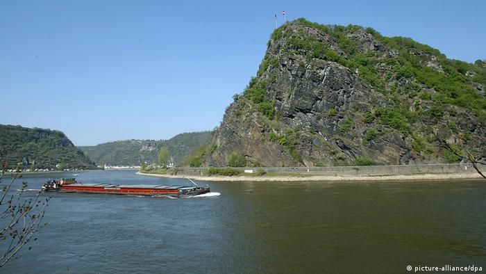
The plain of Terai, a poor agricultural land crossed by holy rivers, straddles the border between Nepal and India. Its sweltering summers see temperatures climb above 100 degrees, but this parched terrain might be on the verge of tumultuous changes. On the Nepali side is the small city of Lumbini, which, after long neglect, is now at the center of great power politics.
This is where the Lord Buddha was born, about 2,500 years ago, under a bodhi tree at the bend of a small creek. His mother, a Hindu princess called Maya, was traveling to her parental home in Kapilavastu when her labor started, and all her entourage could do was stop and arrange a place for her to give birth under the tree, near a pool of water.
Lumbini, sometimes called "the Buddhist Mecca," has been described as a potential gold mine for Nepal, and many have been lamenting that its impressive tourist potential should be so underdeveloped, with just a small white temple sitting on the holy grounds. Those who come, though, appreciate the calm of the place, and sit cross-legged in meditation, or murmur sacred scriptures in small groups. Monks and nuns from all over the Buddhist world tour the temple, which shelters a series of carved stones that depict the holy birth, and just sit on the grass outside, in contemplation.
The idea of developing Lumbini has long been toyed with by various organizations, from the World Federation of Buddhists to the United Nations, not forgetting numerous Nepali agencies that have looked at the birthplace of the Buddha as a possible resource. The U.N. got its eyes on Lumbini early on, under the presidency of U Thant, himself a Buddhist, who visited in 1967. Three years later, the U.N. International Committee for the Development of Lumbini (now the U.N. Lumbini Development Trust) was established, with the approval of the Hindu King Mahendra, traditionally regarded as a descendant of Hindu gods.
In 1972 the committee selected Japanese architect Kenzō Tange to draw up a project for a Peace Park that would surround the temple, approved by the king (who died later that year) and the committee itself. Six years and a few more high-level U.N. visits later, part of what became known as the Tange Master Plan is now partially built. Arched red-brick bridges reach over a straight canal, and a red-brick museum with a Bauhaus-like flair to it sits by a reflecting pool about a quarter of a mile from the small white temple.
The U.N. involvement means a lot of emphasis is given to representing Buddhist nations: On one side of the canal, every country that follows the Theravadha ("Small Vehicle") tradition of Buddhism—such as Burma, Cambodia, Laos, Sri Lanka and Thailand—has, or will have, a temple. The other side is reserved for the countries following the Mahayana tradition ("Greater Vehicle"), like China, Japan, Korea and Mongolia. It translates into a hodgepodge of styles and many replicas of famous buildings. Burma has built a concrete Shwedagon Pagoda; China, a smaller version of the Forbidden City. So far only about a dozen of the foreseen 42 buildings have been erected. One of the problems has been the lack of cash: The finished project should cost about $64 million in total, but not all contributing Buddhist countries see this as a priority.
Enter the Asia Pacific Exchange and Cooperation Foundation (APECF), a well-funded Chinese association headed by a rather mysterious figure, Linus Xiao Wunan. A Buddhist and a Chinese Communist Party member, he wants to see a whole Peace City built here and a tower called "Lumbini Cloud."
"We have already broken ground," says Mr. Xiao, in his living room in a diplomatic compound in Beijing, showing an artist's impression of a tall and slender "celestial observatory" building that will host restaurants, temples, shops and prayer rooms in a circular ring built several hundred feet from the ground. "We have agreed on a project with VTP Global," he says, referring to a theme-park development group based in London. Around him, a confusing array of pictures hints at a complex biography: At the back, Mr. Xiao is seen posing next to the Dalai Lama, whom he met in Dharamsala, where the Tibetan government in exile resides. Other photos show him surrounded by high prelates of various Buddhist sects. But next to where he sits, on a coffee table, is a portrait of Mao Zedong.
"We have the full support of the Nepali government," he says. Not that Nepal has much of one at present, since a caretaker administration has been sitting in Kathmandu for the past 10 years. Before that, a lengthy civil war led to a short-lived communist government, which subsequently collapsed. The next elections are scheduled for November. The caretakers are headed by Pushpa Kamal Dahal, the former leader of the Maoist guerrilla known as Prachanda, or "the Fierce," who also sits on the board of the Lumbini Cloud Project, and has signed a memorandum of understanding (MOU) with Mr. Xiao to go ahead with it.
Not everyone is in accord, and some even see self-interest in Dahal's motives, but Mr. Xiao is not troubled with these developments. Yet he remains vague on many details—like questions about where the $3 billion he claims to have for Lumbini is coming from, or if the Chinese Ministry of Foreign Affairs is backing APECF.
"APECF is part of the grander strategy of increasing China's soft power," Mr. Xiao says, "but we are independent, and the Lumbini development project is our own idea."
Still, China is also getting busy building an international airport here, with direct flights from major Chinese cities, as well as restaurants and hotels to cater to the devout masses.
The U.N. is also still involved: Ban Ki-moon, the Secretary General and himself a Buddhist, has often mentioned the need to develop Lumbini, and those in the know say that the push comes from Mr. Ban's mother, a fervent Buddhist. At least one Korean sect, called Chhoge, has been received by Mr. Dahal for this very reason, and according to Nepali newspaper reports Mr. Dahal has signed an MOU with it, too.
"Our plans are not incompatible," says Mr. Xiao in Beijing. "This is going to be for the whole Buddhist world. To those who find it too striking, I say: At the beginning nobody liked the Pyramid at the Louvre."
India, once more, is left looking uneasily as China expands its influence in its backyard, tapping into the soft-power potential of Buddhism, and an air of Buddhist Great Game can be felt in what was until now the sleepy, holy site of Buddha's birth.
Ms. Sala is a writer based in Hong Kong.


網誌存檔