- 作者:威廉.史考特.威爾森 追蹤
- 譯者:陳正芬
- 出版社:遠足文化
- 出版日:2016/11/23
第一章 江戶(東京)
旅行時
不可任性為之
時時抱持憂患意識
反能順心如意
八隅蘆菴
佛羅里達州的邁阿密和日本東京之間的飛行時間,大約為七個半小時,有很充裕的時間來思考接下來的旅程。我計畫獨自一人走完六十英里的木曾山脈,夜宿沿路的傳統客棧,我用這種方式徒步旅行過好幾次,一直都很喜歡,然而此刻我被困在狹小的座位,吃著來源可疑的食物,看著了無新意的電影,左邊乘客的身體佔掉一個半的座位,給予我許多時間質疑這趟旅行是否明智,這位鄰座枕著我的肩膀酣睡,因為在他隔壁坐著更龐大的身軀,似乎無意與他共用扶手,幸好我至少還是靠走道的座位。
睡在我隔壁的這位乘客中途醒來,他說他在軍隊服役,正要前往菲律賓,我問前一個駐紮地在哪裡,他回答是烏茲別克,又說那必定是在歐洲某處,因為那裡的人似乎都在說德文(譯註:烏茲別克位在中亞)。我思索這個有趣的旅行資訊,決定別再吵他,前往馬尼拉的路途遙遠,或許對他來說,那是個位在南美洲的國度。
最後,飛機順利降落在成田機場。沒有人想翻看我歷經風霜的背包,於是我迅速通過海關,買好往東京的急行列車車票,在這一個半小時的車程中,我幾度睡著,幾度在晃動中醒來。從漆黑的車窗往外看到熟悉的光景,居酒屋前的紅燈籠,寫著漢字的霓虹招牌,時不時出現的Lawson或Circle K等便利商店。列車最後進入新宿站,我通過迷宮般的廊道,叫了一輛計程車,前往神樂坂。
神樂坂地處山丘,過去是藝妓所在的花街,如今充滿傳統的酒館飯館,來迎合有錢或花錢不眨眼的人們。計程車停在山丘頂上一間橘紅色和白色相間的佛寺前,我付了車費給和藹的司機後,便鑽進對街狹窄的巷道,順著崎嶇的卵石地來到和可菜旅館。一進大門有個小花園,拉開前門跨過門檻,貓咪端坐在低矮的木桌上,小梗犬英勇地吠著衝出來迎接我,走在後面的是客棧女老闆
木曽街道(きそかいどう)は、京と江戸を美濃国および信濃国を経て結んでいた山道の俗称である。
概要[編集]
古代から中世の吉蘇路[1]、江戸時代の中山道(木曽路)のこと。当時は木曾街道と書いた。狭義には、中山道のうち、美濃国と信濃国の境界部に当たる木曽地方の一部区間を指した。贄川宿・奈良井宿・薮原宿・宮ノ越宿の上四宿、福島宿・上松宿・須原宿の中三宿、野尻宿・三留野宿・妻籠宿・馬籠宿の下四宿からなる11の宿場が設置された。
『日本鹿子』第八に『京より江戸まで木曾街道を行』とあるほか、『皇都午睡』三編中にも『板橋宿は、中仙道木曾街道の咽首なれど』とある。また、明治新政府が編纂した古事類苑地部では『木曾街道』の項を設け、主に木曽路(木曾路)について説明している。
『橘庵漫筆』二では、木曾街道は、かつては今のように人馬の通行は殆ど無く、昔は山姥に遭遇するなど通行困難な路であり、善光寺を詣でるにも、木曾街道を行けば百里で済むところ、命の方が大事と二百里もある北陸道を経る場合も多かったことや、かの平家でさえ京より関東に出るのに北陸道を用いたことを書いており、木曽路がたいへんに険しい道であったことを述べている。

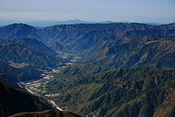
The Kiso Valley (木曾谷, Kiso-dani) is a geographical area that centers on the valley of the upper portions of the Kiso River in the southwestern part of Nagano Prefecture in Japan. It is a v-shaped valley with length of approximately 60 km (36 mi) that follows the river as it flows from north by northwest to south by southwest into Gifu Prefecture.[1]
Access[edit]


Through much of Japan's history, the Kiso Valley was used to connect the former Mino and Shinano provinces. However, it came to be known as a difficult route because of its steep climbs. The Shoku Nihongi recorded that the Kiso no Yamamichi (岐蘇山道) was opened in 702. The same route was again mentioned in a 713 article, but it was then called the Kisoji no Michi (吉蘇路). The Kisoji (木曽路) would eventually follow the same path. However the official Tōsandō did not run through the Kiso Valley; instead, it ran from Mino Province towards the Kamisaka Pass and into the Ina Valley. During Japan's Middle Ages, the Nakasendō, an old trade route, ran through the valley, which led to the creation of eleven post stations along the route. Since the Meiji period, the Chūō Main Line (for trains) and Route 19 (for vehicles) have been cutting through the valley.
Kisoji

The Kisoji (木曽路, Kisoji) was an old trade route in the Kiso Valley that stretched from Niekawa-juku in Nagano Prefecture to Magome-juku in Gifu Prefecture. There were eleven resting spots along the route, all of which became part of the Nakasendō when it was established.[1] There is an article dating from 713 in the Shoku Nihongi that records the route’s characters as 吉蘇路.
There are two stone markers that indicate the end points of the Kisoji. One is located between Motoyama-juku and Niekawa-juku and states "From here south: Kisoji" (是より南 木曽路 Kore yori minami, Kisoji). The other marker is located between Magome-juku and Ochiai-juku and states, "From here north: Kisoji" (是より北 木曽路 Kore yori kita, Kisoji).
Additionally, the early 20th-century author, Shimazaki Tōson, wrote about the effects of the Meiji Restoration on the Kiso Valley in his novel, Before the Dawn. He grew up in Magome-juku, hence his featuring the area in his novels.
After the Meiji period, the Chūō Main Line and Route 19 were established, which roughly follow the Kisoji's path.
Stations of the Kisoji[edit]

- 1. Niekawa-juku (Shiojiri)
- 2. Narai-juku (Shiojiri)
- 3. Yabuhara-juku (Kiso (village), Kiso District)
- 4. Miyanokoshi-juku (Kiso (town), Kiso District)
- 5. Fukushima-juku (Kiso (town), Kiso District)
- 6. Agematsu-juku (Agematsu, Kiso District)
- 7. Suhara-juku (Ōkuwa, Kiso District)
- 8. Nojiri-juku (Ōkuwa, Kiso District)
- 9. Midono-juku (Nagiso, Kiso District)
- 10. Tsumago-juku (Nagiso, Kiso District)
- 11. Magome-juku (Nakatsugawa)
See also[edit]
| 坐標:35°50′31″N 137°41′29″E | |
| 國家 | |
|---|---|
| 地方 | 中部地方 |
| 都道府縣 | 長野縣 |
| 接鄰行政區 | 松本市、鹽尻市、伊那市、木祖村、上松町、王瀧村、宮田村、高山市、下呂市 |
| 面積 | |
| • 總計 | 476.06平方公里 |
| 人口(2007年9月1日) | |
| • 總計 | 13,580人 |
| • 密度 | 28.5人/平方公里 |
| 時區 | 日本標準時間(UTC+9) |
| 町編號 | 20432-3 |
| 郵遞區號 | 〒397-8588 |
| 町役場地址 | 長野縣木曾郡木曾町福島2326番地6 |


沒有留言:
張貼留言